Last month the New South Wales State Government released what they call a ‘Special Activation Precinct’ Masterplan and Amendment to the 2006 Kosciuszko National Park Plan of Management.
I hadn’t really heard of a ‘Special Activation Precinct’ before, but it made me think of China’s ‘Special Economic Zones’ like Shenzhen, which went from being a town the size of Newcastle in 1982 to a city with the population of Sydney + Melbourne + Brisbane + Perth +…you get the idea, in 2020. That and the endless fascination the word ‘precinct’ seems to hold across all levels of government.
It turns out ‘Special Activation Precincts’ are a state government policy of the last 3 years. To quote from the NSW Department of Planning, Industry and Environment:
“Special Activation Precincts are a new way of planning and delivering industrial and commercial infrastructure projects in dedicated areas in region (sic) NSW, by bringing together planning and investment support services.”
So far there are two, one in Parkes and one in Wagga. Both are enormous industrial parks taking advantage of the construction of Inland Rail through the towns. They seek to streamline the delivery of rezoning and necessary infrastructure to build huge industrial parks featuring solar farms, recycling and waste facilities, logistic hubs and high intensity agriculture and manufacturing, think feedlots and abattoirs.
Now this might seem a far cry from the Snowy Mountains, but I think it speaks volumes about the government’s intention here that they’ve chosen to use this particular policy instrument to plan the future of our fragile alpine ecosystems.
The 2021 Snowy Mountains Special Activation Precinct Draft Masterplan and Draft Amendment to the Kosciuszko National Park Plan of Management (henceforth ‘the plans’)
The plans make the persuasive argument that much has changed since 2006 and it’s time to reassess some of the assumptions made at that time. What’s interesting here is a chance to compare the values of government 15 years apart. The 2006 plan focuses on limiting growth. In fact, in a period following on from fairly substantial growth in the Thredbo Valley in particular, the 2006 plan effectively blocks any additional growth in terms of bed numbers and seeks to wind back commercial access as leases run out.

One example of this is the Ski Rider motel (on the Kosciuszko Road between Sawpit Creek and Sponars) which was due to have its lease expire in 2025. The 2006 plan stated in no uncertain terms that it wouldn’t be renewed, on the grounds of limiting sprawling human landuse along the road corridor.

The 2021 plan on the other hand, celebrates the growth in demand for park visitation and sets the stage to facilitate further growth as much as possible. This includes extending the lease of Ski Rider, amongst much else.
It’s a complex plan and I can’t say I’m 100% around the details, so I’ll refer you to:
- The Masterplan itself
- The Amendment to the National Park Plan of Management, and
- The National Parks and Wildlife Association response to the plan.
The National Parks Association is a charity I support that lobbies to expand and improve our national parks as well as supporting visitation and access. The fact that an organisation that activity supports human use of national parks is so opposed to the plan is a fair indication in my mind of its abundant flaws.
What I do want to focus on is a few things that jump out at me.
Did somebody say ‘Fragile Alpine Ecosystem’?
Hello commercial air movements
Since at least 2006 commercial air movements have been prohibited in the Kosciuszko National Park. If you’ve spent any time down at the Snowies you’ll likely be aware of this as the skies are largely empty. When a chopper does come over, you know that it’s probably involved in an emergency rescue. For me, this relative quiet is an important part of enjoying what the 2006 and 2021 plans refer to as the ‘solitude and self-reliant and adventurous recreation’ that I like to undertake in the park.
The 2021 plan aims to remove this prohibition and allow commercial aircraft to take off and land at Perisher, Thredbo and Charlotte Pass. This would mean the rich and famous could chopper into our alpine resorts from Cooma Airport or Canberra.
Imagine: enjoying the blissful quiet of a snowy winter evening, watching the lights of the groomers make their way up and down the hill, only to hear the ever-increasing thrum of a chopper rotor getting nearer. The noise becomes overwhelming and you wander down to see what the emergency is. Oh, it looks like the Morrison family have decided to duck down from the Lodge (as opposed to a lodge) to take some selfies in the snow!
The serenity of Charlotte Pass Village has traditionally been taken fairly seriously in planning. Parks don’t plow the road pass Spencers Creek, so in winter you need to travel on an oversnow vehicle or a small bus, depending on how much snow cover there is. For at least the last 25 years, aside from management vehicles and these public transport vehicles, no motorised private cars have been allowed into the village in winter. It strikes me as absolutely insane to think that helicopters won’t ruin the alpine village ambience whilst acknowledging that cars will.
As well as the shuttling of those who are happy to burden the rest of us with the externalities of their convenience, we would likely see tourism operators start running chopper joy flights out of Thredbo and Perisher. It would also be possible under the plan for a company to apply to run heliskiing on the main range, an area that is currently remarkable for how peaceful and quiet it is in the winter, being only accessible on skis or snowshoes from either Charlotte Pass, Guthega or Thredbo.
Hello commercial vehicles on the Summit Trail
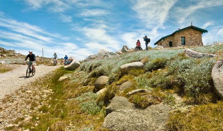
The second huge commercial overreach of the 2021 plans is to reallow commercial vehicles on the Summit Trail. For those that don’t know, the Summit Trail is an extremely popular walking track and boardwalk from the top of the Kosciuszko Chairlift at Thredbo to Seaman’s Hut for the summit of our highest mountain and then continuing around to Charlotte Pass. In Summer, and to a less extent the shoulder seasons, this walking track is enormously popular. As in, very popular. Like, it’s hard to explain just how hectic parking at Charlotte Pass gets on public holidays and weekends if you haven’t seen it.
This demand is in part why the State Government feels the 2006 plan that focused on limits to growth needs amending, and it’s easy to see their point. People really want to visit the park and we could be managing that better.
As recently as the 1960s you could drive up the Summit Trail along the Kosciuszko Road as far as Seaman’s Hut, park there and bag the easiest of the 7 summits. At some point the excellent decision was made to close the road at the Pass and turn it into a track for walkers, bike riders and the occasional park ranger in a ute. Of course, the road is maintained to allow Parks to service the facilities at Seaman’s and for emergency vehicles to get through.
The 2021 plan seeks to reallow commercial operators to use the road to run small buses for up to 20 visitors at a time. This is apparently “for the transport of multi-day Snowies Iconic Walk participants”. The Snowies Iconic Walk seems to be a project to upgrade some of the tracks around the Park to create an Overland Track style multi day hike. Why on earth tourism operators would need to run buses up the side of our highest mountain to facilitate people doing a 4 day 55 kilometre bushwalk is not clear to me.
Now with 40% more beds!
Perisher, Charlotte’s and Thredbo have hardly grown in my adult lifetime whilst the popularity of visiting the two major resorts has absolutely exploded. Note that lift ticket prices have doubled in ten years, whilst the same number of accommodation beds in each resort are still available. This seems problematic, but it’s for a sensible reason. Alpine ecosystems are extremely fragile, so much so that on the main range you can see the paths that 4WDs cut decades ago. The 2006 plan set the bounds of future development on the footprint of existing development and limited any increases in number of beds to contain the impacts of construction, vehicle movements and waste generation. The 2021 plans seeks to grow the number of accommodation beds available across the 3 resorts by 4,144, an increase of roughly 40% on what is there now.
I like to think that there is a way this could occur in an ecologically sensitive manner, but it’s hard to imagine that level of construction and inhabitation could do anything but negatively impact on the ecology of the park. I can only hope that if they do go ahead, it is within the existing bounds of the developed resorts and is done is a sensitive manner.
One possible way to increase capacity in the resorts would be focus on redeveloping Perisher, rather than Thredbo, Guthega, Smiggins and Charlotte Pass. Perisher benefits from rail access to bring in guests and goods and even take out waste. At the moment Perisher resembles a sort of sprawling suburbia/car park with a brutalist transport interchange in the middle of it. I wouldn’t be opposed to a master plan that sought to redevelop Perisher into an eco-focused walkable village along the lines of Thredbo or a miniature Whistler or Banff or Nozawa Onsen. There are ways to implement some growth in a sensitive way, but this plan doesn’t give me any real faith it will be handled well.
A Bypass for Jindabyne
Aside from all that negativity about the wanton overdevelopment of one of our states most fragile ecosystems, there are a few things to like about the 2021 plans. Two of the stated key drivers for change that particularly excite me are:
- Prioritising people over vehicles in Jindabyne providing access and ensuring walkability and pedestrian safety
- The connection to Lake Jindabyne, ensuring public spaces take advantage of views andvistas, along with the provision of improved linkages to the Town Centre
I’ll be frank; I don’t like Jindabyne. Every time I drive through Jindy, which is fairly often (see above), I can’t help but think what Jindy could be. Before I had skied overseas I didn’t think much of it. It was a glorified strip mall on the way to the snow. Nothing wrong with that, it met an important need! Where else to get alpine diesel, last-minute replacement goggles and rent chains?
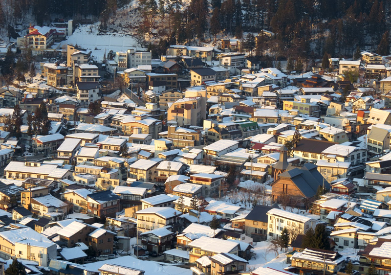
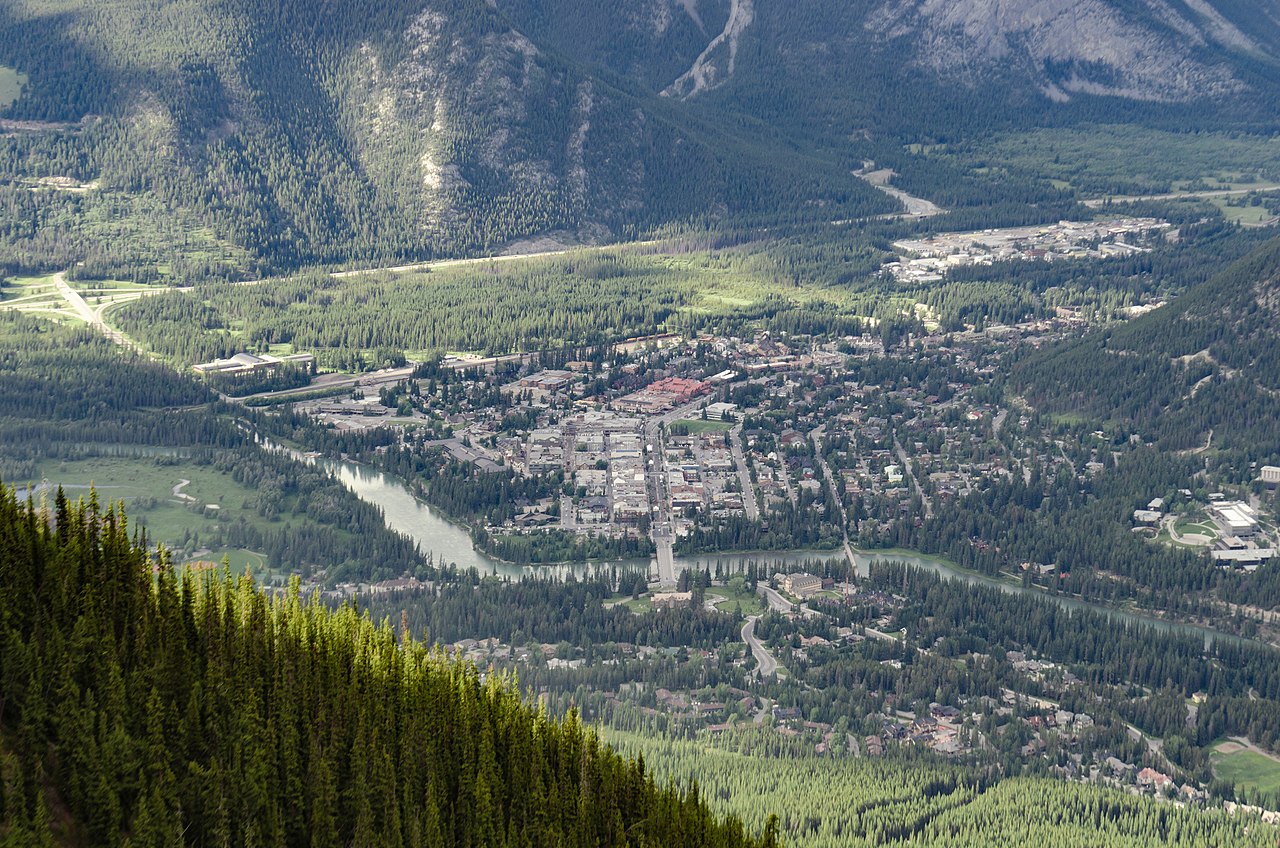
Now though, having seen how things are done in Canmore, Banff and Whistler in Canada and Nozawa Onsen, Myoko and Hakuba in Japan, I can’t help but think what a real tourist town alpine village can be like and wonder how on earth the auto-centric hellscape of Jindabyne is what we got stuck with!? It’s tempting to blame the Snowy Mountains Hydro Scheme, they did flood the valley and built the town after all. But we managed to build Thredbo with some sort of cohesive, walkable style, so why haven’t we done anything to fix Jindabyne? The way I look at it, the town has only gotten worse over those intervening years. In season it’s one long traffic jam of people trying to get out of there.
With the kind of investment the plans are talking about Jindabyne could be a player on the scale of those destinations in Japan and Canada, or the no doubt countless European examples I don’t have first hand experience of.
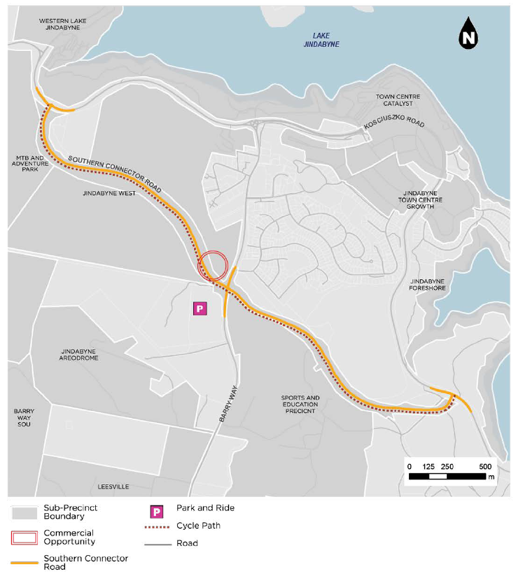
The good news is, the Special Activation Precinct Masterplan (SAPM) seems to be serious about realising the vision. The main thing holding Jindy back is the fact that a 4 lane highway traverses right through the guts of the town, cutting its strip-mall main street off from the lake and parklands. This will be addressed by building a ‘Southern Connector’ bypass of the town. The old highway will be cut down from 4 lanes to 2 with bike lanes, trees and hopefully footpaths that are still sadly lacking. The whole town centre will be redesigned to put the emphasis towards Snowy River Avenue and Thredbo Terrace and away from the highway. The parklands and foreshore will be dramatically improved, and lots will be rezoned, encouraging an increase in density and walkability in the town centre.
Further than that, the mountain bike and walking trail infrastructure around the town is set for huge improvement which will hopefully mean that more and more outdoor recreation can happen in and around town and not take place exclusively in the National Park, which we might pause and consider, was originally set aside for ecological conservation rather than to facilitate economic growth.
They’ve also flagged the entirety of the caravan park, which takes up the best part of the town, sprawling across the lakeshore immediately across the road from the main shops, to be redeveloped into a little beach, parkland and “future development site”. You know an Australian tourist town has really made it when they finally get the caravan park out of their main street. Of course, we will lose some of the cheapest accommodation in the town, but hopefully this will be more than made up for with abundant alternatives around the place. Hopefully including some free camping opportunities nearby!
There’s lots more to the plan for Jindy, including a huge mountain bike park accessed by a gondola and a big new caravan park located further around the lake. It’s worth checking out in the masterplan.
This really feels like a chance to breath some fresh life into the town and create that year-round outdoor sport and rec hub the state government is looking for.
But still not getting serious on public transport
The SAPM makes the first real inroads into developing something resembling a proper public transport system for the Snowies. It outlines an idealised future network with year-round service on 3 limited stops bus routes; T from Jindabyne to Thredbo via Bullocks Flat, P from Jindabyne to Perisher (extending to Charlotte Pass in Summer) and G from Jindabyne to Guthega. These buses would leave Jindy Town Centre, stop at a new park and ride facility on the Southern Connector Bypass on the outskirts of Jindy before making their way to the resorts.
At the current point in time there is no viable public transport options in the valleys. Greyhound head to Thredbo via Bullocks Flat (for Perisher) once a day and there’s a bunch of other operators that you can book onto for skiing day trips. But if you’re in a group (of a few as 2), own a car and a set of chains or are travelling in summer, the best, cheapest, fastest and most convenient way to get up into the mountains has always been to drive.
This has created the unfortunate situation where the roads and car parks are basically at capacity during peak times. On busy weekends in winter Thredbo literally turns cars away and at Charlotte Pass in summer the cars parked along the Kosciuszko road can extend for kilometres.
It is a classic case that the best choice for the individual is always to drive which leads to traffic jams, dangerously congested roads in wintertime and sprawling car parks.
Something needs to change, and a frequent, reliable, bus network based in Jindabyne is the obvious solution. If the accommodation of visitors is focused on Jindabyne and a large, centralised park and ride is provided for those coming from further afield, it should be quite simple to provide a good bus service, since pretty much everyone is going to one of two places.
I would think the Alpine Way is the logical route to start with, since you can change at Bullocks Flat for access to Perisher and Blue Cow via the Ski Tube.
The SAPM does outline the bones of what a future network might look like, but it doesn’t do much do indicate that there is the will to get us there. The page on improving public transport ends with the rather weak promise that:
“Over the course of the next year the Department of Regional NSW and Transport for NSW will lead an initiative to trial a shuttle service, to reduce pressure on Alpine Way and Kosciuszko Road and provide further data to support the development of a park and ride service in line with the Master Plan.”
This doesn’t seem like much of plan when we’re talking about a fragile ecosystem that experiences road closing extreme weather events and is already at capacity, oh, and we’re planning on increasing accommodation availability by 40% in the alpine villages and growing Jindabyne by at least the same amount.
The real deal is apparent on the next page of the masterplan, which states plans for more parking at Perisher, Smiggins, Pipers Gap, Charlotte Pass and Thredbo. The numbers aren’t spelled out, but if there is a more destructive thing we could do to our alpine valleys than pouring concrete and bitumen over them for the storage of private vehicles, I don’t know what it is.
The other overlooked element here is connections to Jindabyne from the outside world. As it stands you can fly to Cooma and take a bus or taxi connection to the snowfields, but short haul flights don’t really fit in with the whole ‘limiting human impacts on alpine ecosystems’ thing, so hopefully that isn’t something we foster. Instead, we need better public transport from Canberra and Sydney to Cooma and from Cooma to Jindabyne. There should be more than one public coach a day connecting Canberra to Cooma. Maybe even investigate the possibility of reopening the railway line that was closed in the 80s.
The future of our alpine resorts should be about building walkable villages with solid, all day, year-round affordable public transport connections and limited and expensive parking for those that need it. Alas, it looks like the bulk of the increase in people visiting the area will continue to do so by car.
Last but definitely not least
The elephant in the room for this whole hoo-ha is obviously climate change. The revisions to the plan of management acknowledge increasing maximum temperatures, significantly reduced precipitation and a dramatic reduction in the number of nights that are suitable for snow making. This might make the decision to build great swathes of new tourism infrastructure strange, but it isn’t. This plan is about repositioning the Snowies as a year-round destination. The snow sports focus is being phased out. The end of white winters won’t spell the end of the Snowies, not if the NSW government can help it. Instead, escape the endless heat! Climb to the top of Australia and enjoy being outdoors again, like you once did on lower climes. Lest we forget.
Public exhibition on the plans is currently open until August 23rd. You can read all about the plan and make your submission here. I would also encourage you to read what the National Parks Association of NSW have to say about the plans here.